

Features:
With its added processing power and new slimline design featuring edge-to-edge glass and a smaller unit footprint, it's easy to retrofit this plotter in a wider range of dash configurations
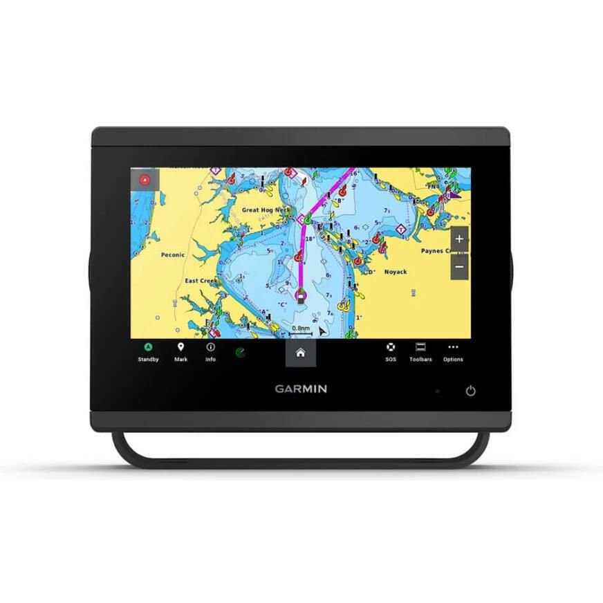
Bring a fresh new look and feel to your chartplotter with preloaded Garmin Navionics+ charts
Get support and integration for your Force trolling motor (sold separately) to gain complete control while you fish
View laylines, race start line guidance, enhanced wind rose, heading and course-over-ground lines, true wind data fields and tide/current/time slider, wind angle, set and drift, wind speed, polars and more
Use the polar table to see key data, including how fast you should go at a certain wind angle and speed so you know whether you need to adjust sail trim
If you have multiple compatible Garmin devices on your boat, you can share information such as maps, user data, radar and IP camera video
Connect to compatible autopilots, digital switching, weather, Fusion-Link™ audio system, media, VHF, AIS and more from one screen
Built-in Wi-Fi® connectivity pairs with the free all-in-one mobile app for access to the OneChart™ feature, smart notifications, software updates, Helm, Garmin Quickdraw™ Community data and more
Connect with some of your favorite devices, such as quatix® marine watches, gWind™ Wireless 2 transducers, GNX™ Wind marine instruments and wireless remote controls
Pair your inReach satellite communicator to your chartplotter, and type custom messages by using your MFD's on-screen keyboard
Specifications:
Dimensions: 7.6" x 5.5" x 2.9" (19.2 x 14.0 x 7.4 cm)
Weight: 2.8 lbs (1.3 kg)
Waterproof: IPX7
Display type: WSVGA
Display size: 6.1" x 3.5"; 7.0" diagonal (15.4 x 9.1 cm; 17.8 cm diagonal)
Display resolution: 1024 x 600 pixels
Mounting options: Bail, flat or flush (Garmin does not offer any hardware or accessories for a flat-mount installation. Professional tools and knowledge is required.)
Accepts data cards: 2 microSD cards
Waypoints: 5,000
Track points: 50,000
Tracks: 50 saved tracks
Navigation routes: 100
Power input: 10 to 32V DC
Typical current draw @ 12V DC: 1.08A
Maximum current draw @ 12V DC: 1.45A
Maximum power usage @ 10V DC: 17.6W
Traditional sonar (dual frequency/beam): Yes (with GCV™ black box, sold separately)
ClearVu: Yes (with GCV™ black box, sold separately)
SideVu: Yes (with GCV™ black box, sold separately)
NMEA 2000® ports: 1
Connections NMEA 0183 input ports: 1
NMEA 0183 output (TX) ports: 1
Video input ports: 1 (BNC composite)
J1939 ports: 1
Garmin marine network ports: 1
Included:
GPSMAP 743 chartplotter
microSD™ card preinstalled
Power cable
NMEA 2000® T-connector
NMEA 2000 drop cable (2 m)
Bail mount kit with knobs
Flush mount kit with gasket
Protective cover
Trim piece snap covers
Documentation